


Bhutan launched its five-year red panda conservation strategy in September 2019. Under the leadership of Bhutan's Ministry of Agriculture and Forests, Nepal's Department of National Parks and Wildlife Conservation, and Bhutan's Department of Forest and Soil Conservation, Red Panda Network (RPN) played a key role in advocating for and developing the plan, as well as ensuring its effective implementation. We're delighted to discuss our work thus far.
Bhutan's red panda conservation strategy included three main goals:
Objective 1: Enhance red panda monitoring capability. Objective 2: Gain knowledge of red panda habitat utilization and conservation issues in Bhutan's southwest area.
1. Improve red panda monitoring capability.
We required defined protocols and training to better familiarize the survey crew and educate new team members in order to collect accurate data to help create red panda conservation strategy.
The Red Panda Monitoring Protocol for Bhutan was developed in collaboration with a team of forestry authorities with experience in red panda protection. The program included training on survey design and procedures, as well as theory and practical workshops that offered participants hands-on data collection experience. The methodology was used to teach a team of eight officials from four field divisions as part of the 'training of trainers' (ToT) program. These authorities then trained survey team members from their respective divisions.
Objective 2: Gain a knowledge of red panda habitat utilization and conservation issues in Bhutan's southwest area.
The scientists used forest type, height, and proximity to human populations as characteristics to identify probable red panda habitats. They mapped the land with a 4x4 square kilometer biodiversity monitoring grid and picked 135 grids to survey. Half of these grids were inspected for red panda signs and vegetation samples, while the other half were chosen for camera trapping.
Survey of Red Panda Signs
The survey crew hiked four-to-eight-kilometer trail pathways (also known as transects) within each grid, looking for indications of red pandas. When the trails were less than 4 kilometers in length, the crew inspected three shorter routes of at least one kilometer in length. The survey crew started each route with a 25-meter radius plot and then added 25-meter radius plots every 500 meters along the way. The survey crew looked for firsthand sightings of red pandas as well as indications of red panda behavior inside those plots.
The researchers also assessed the vegetation structure and composition of red panda habitats throughout these studies. To calculate the basal area, tree heights and diameters were measured and recorded (or the average amount of an area occupied by tree stems, canopy cover, and forest density). Bamboo and bushes were numbered and measured, and plant species were also noted. The crew also gathered physical information such as aspect, height, slope, and distance to water source.
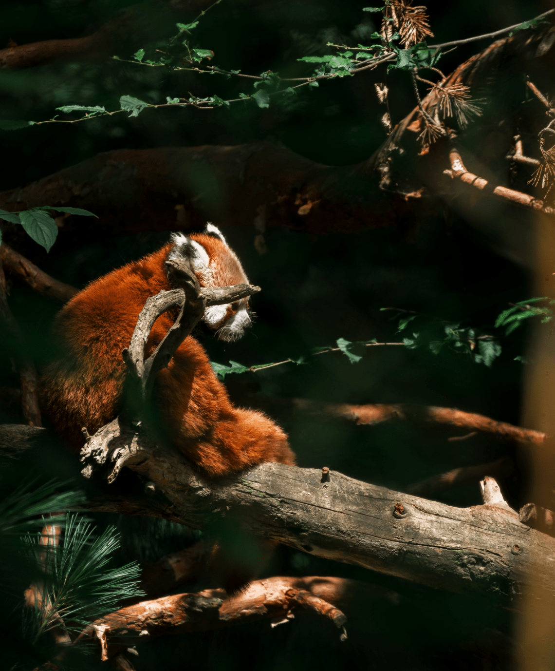
The survey teams documented several direct sightings of red pandas as well as evidence of red panda activity in the form of droppings and footprints.
Camera snaring
In order to identify evidence of red pandas and supplement the data acquired through the sign survey, camera traps were put in 50% of the survey grids. During the research period, the camera traps were checked at least once to change batteries and memory cards and to confirm camera performance. The survey crew collected the data from the camera traps three months later.
Findings from a Sign Survey and a Camera Trap
The crew inspected 1083 plots (within a 25-meter radius) and found red pandas in the Gedu Forest Division, Dagana Forest Division, Samtse Forest Division, and Jigme Khesar Strict Nature Reserve. According to the study, just 10% of the southwest Bhutan region is suitable for red pandas.
More over half of the plots assessed exhibited signs of red panda danger. Signs of livestock husbandry (37% of plots), non-timber forest product (NTFP) collection (17%), wood harvesting (13%), infrastructure (6%), and stray dogs (2%), were the most prominent risks. One encouraging discovery was that the survey crew found no evidence of red pandas being targeted.
“The research gave fresh insights on red panda habitat appropriateness and connection between diverse conservation areas, thanks to the assistance and participation of the Red Panda Network. The research has also assisted us in taking a further step toward red panda conservation by investigating the genetics of red pandas in Bhutan.”